|
The Location of Limousin
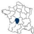
The modern region of Limousin is located in the
central part of France, on a series of rolling
plateaus in the northwestern part of the Massif
Central. It is bounded by the départements
of
Indre and
Cher, in the region of
Centre to the north,
Allier,
Puy-de-Dôme and
Cantal, in the region of
Auvergne to the east. The département
of
Lot, in the region of
Midi-Pyrénées,
is to the south, Dordogne is to the southwest, the département
of Charente, in the region of
Poitou-Charente, is to the west and
Vienne, in Poitou-Charente, is to the northwest.
Limousin is comprised of three départements:
Corrèze,
Creuse and
Haute-Vienne. The region’s capital is
Limoges.
The Blond Mountains are located in the southwest,
between the Vienne and Gartempe rivers, and rise to
more than 1600 feet. The Ambazac Mountains, to
the east, rise to more than 2300 feet.
The History of Limousin
During the
Pre-Roman and Roman periods [50 BC to 550 AD], the
general area of Limousin was inhabited by a Gallic
tribe known as the Lemovices. The name Limousin is
derived from that Gallic name.
Under the Romans, the area became a part of the
province of
Aquitania.
During the 6th to 8th centuries
the
Merovigian Franks were the rulers. They gave
it the name Pagus Lemovicinus. From the 8th to
10th century it was ruled by the
Carolingian Franks and, in 918, it once again
became subordinate to Aquitaine. During the
Middle Ages it was known for its troubadour poetry.
The 10th century saw Limousin divided into a number of
small governmental [feudal] units. The northern
part of Limousin became the country of Marche.
The counts of Angouleme, Auvergne and Poitou annexed
other parts. By the middle of the following
century, the Duke of Aquitaine, through the viscounts
of Comborn,
Limoges, Turenne and Ventadour, ruled the
remaining territory.
In 1466, Jean Bourbon II, the 6th duke of
Bourbon, was made governor of Limousin [together with
Berry, Languedoc, Orléanais
and Périgord] by
Louis XI. This honor was bestowed as a
result of Jean Bourbon’s contribution to the earlier
rout of the English.
The middle of the 12th century saw increased
competition for Limousin between the French and
English. During
the Hundred Years' War [1337 to 1453], the area
was the scene of heavy fighting. Ultimately,
Henry IV annexed the area to France. It then
became the French province of Plateaux du Limousin, in
1790, with its center at
Limoges. The present region contains much of
the territory formerly found in the old province.
Region of Limousin
Département Information
The Dèpartements of Limousin
|
Corrèze
The département of Corrèze is located on the western border of the Massif Central, in the southern part of
Limousin. It is bounded by the départements of
Creuse in the north,
Cantal and
Puy-de-Dôme, in
Auvergne, on the east,
Lot, in the region of
Midi-Pyrénées, to the south and Dordogne and
Haute-Vienne [Limousin] on the west. In 1790,
Corrèze was formed from the old province of Limousin. The Dordogne River flows through the département.
Tulle is the capital.
Creuse
The Département of Creuse is located on the northwestern border of the Massif Central, and occupies much of the Creuse River basin. The ground, in the southeast of the département, rises to more than 3000 feet. The Creuse département is bounded by the départements of Indre and Cher on the north, Allier and Puy-du-Dôme on the east, Corrèze to the south, and Haute-Vienne on the west.
Creuse was formed, with Guéret as the capital, in 1790 from the old provinces of Marche [a province prior to the French Revolution], plus northern Haute-Vienne and a piece of Indre, Berry [a former province in central France; its capital was Bourges], Bourbonnais [another old province in central France], Auvergne, Poitou, and Limousin.
The area is well known for its stockbreeding of the Limousin cattle. Cereals, chestnuts and potatoes are grown. Industry is poorly developed and scattered and consists of food processing, metal production, mining, quarrying and spinning.
Haute-Vienne
The Département of Haute-Vienne is located in the western part of Limousin, on the northwestern slopes of the Massif Central. It was carved principally from the old province of Marche with samplings of the provinces of Berry, Limousin and Poitou. The département’s north is separated from the south by the westward-flowing Vienne River. The Vienne River traverses the rolling uplands of Limousin before joining the Maulde and Taurion rivers. It then flows through Limoges.
Region of Limousin
Town
Information
The Towns of Limousin
|
The Capital of Limousin - Limoges
Limoges is the capital of the Département of Haute-Vienne and of the Limousin region. It is located in the heart of France, south-southwest of Paris on the right bank of the Vienne River. This places it on the western edge of the Massif Central, about 210 km (130 mi) northwest of
Bordeaux.
Limoges is an ancient community. During its pre-Roman period, it was the capital of a Gallic tribe called the Lemovices. After the Roman conquest, it was called Augustoritum. It became an important Roman center, with its own Senate and currency.
The 3rd century brought Christianity to the small town of Saint Martial, which was located on the hillside overlooking Limoges. Due to the quickly spreading legends of the miracles being performed at the shrine of Santiago de Compostela [located in northwestern Spain] Saint Martial quickly became a stopping-off place for the numerous pilgrimages to the shrine. Santiago de Compostela had become one of the most important of all Christendom’s religious shrines. In the 9th century, the Abbey of Saint Martial was built over the crypt and tomb of Saint Martial. During the 12th century, Limoges became the seat of the viscounty of Limousin.
The power of the Abbot of Saint Martial soon rivaled that of the Bishop of Limoges. During
the Hundred Years’ War, between France and England [1337 to 1453], the two towns found themselves on opposing sides. Finally, the two towns grow into each other, and in 1792 the towns were officially merged into Limoges.
Until the 16th century, Limoges was frequently ravaged by famine, fire and plague. It wasn’t until the later part of that century that it was made the capital of Limousin Province.
The surviving parts of the two medieval towns, now merged into and overgrown by the modern city, can still be recognized by their narrow winding streets that are in contrast to the spacious roads of the newer neighborhoods.
Beginning in 1771, a hard-paste porcelain industry developed near Limoges, where kaolin deposits had been discovered. By the 1800's, Limoges had become one of the largest porcelain centers in Europe.
An American named David Haviland opened a porcelain factory at Limoges in 1842 to make tableware for the American market. Haviland porcelain features soft colors that blend together and small floral patterns.
The porcelain factories have been modernized to use natural gas and have developed new production techniques. Uranium is mined in the region. Other industries include the manufacture of leather products, cotton textiles, and machinery. It is a railway junction on the main Paris-Toulouse line and a trade center for stock farming.
-
Points of Interest
Limoges boasts a ceramics museum [the Musée National de Céramique Adrien-Dubouché] possessing a fine collection of ceramics and porcelain. It was opened in 1867. The cathedral of Saint-Étienne, which was constructed between 1273 and 1520, is the city’s most imposing structure. Its elegant, partly octagonal bell tower is typical of the Gothic churches of the region. The church of Saint-Michel-des-Lions, constructed during the 14th and 15th centuries, has a 198 ft high tower with a spire surmounted by a big bronze ball. The church also possesses an excellent 15th century stained-glass windows. The 18th century Palais de l'Évêché now houses the municipal museum, which has a large collection of old enamels. The city’s
Université de Limoges was founded 1808.
Limoges is the birthplace of Pierre Auguste Renoir.
-
Economic Activity
Since 1771, Limoges has been famous for its fine porcelain that is made from nearby deposits of kaolin. It is also an industrial and commercial center in south central France. Limoges also produces automobile parts, electrical equipment, leather goods, including shoes, paper and textiles. Uranium is mined in the vicinity.
Aubusson
Northeast of Limoges, on the Creuse River, in the Département of Creuse, is the market town of Aubusson. The town is well known for its high quality wool carpets and tapestries. In 1869, a National School for the Decorative Arts was founded in the town.
Brive-la-Gaillarde
Brive-la-Gaillarde is a town lying along the Corrèze River in the Corrèze Département, just south of Limoges. It is located in a fertile area that was the juncture of three old French provinces…Limousin, Perigord and Quercy. In the Middle Ages it was the capital of lower Limousin. It owes its growth to its positioning on the Paris-Toulouse and the
Bordeaux-Geneva railway and road routes.
There are rock caves, in the surrounding areas, that evidence a prehistoric occupation. The town itself was the result of a Roman settlement where they built a bridge over the Corrèze River with the Latin name of Briva Curretiae. In 1226 Saint Anthony of Padua built a monastery there. The 12th century church of Saint-Martin is a novel example of Romanesque architecture coupled with Limousin art.
The area’s economy is primarily agrarian with fruit, grain, poultry and pork the primary products; it is an important agriculture market. However, there is also some light and heavy industry.
Guéret
Guéret is the capital of the modern Département of Creuse, and was the feudal capital of the old French province of La Marche. It is located about 45 miles northeast of Limoges, in the foothills at an elevation of 1440 feet. With the coming of the railway, the town has grown from a small market town into becoming the center of the local agricultural cooperatives. Over the years, the town expanded about a 7th century abbey.
The town’s most impressive structure, the Hotel de Money-roux, is the 15th century mansion that houses the local archives. The municipal museum displays an interesting collection of 12th to 15th century Limoges painted enamels.
Oradour-sur-Glane
Oradour-sur-Glane was a village in the Département of Haute-Vienne, located about 14 miles northwest of Limoges. It was the site of a brutal Nazi atrocity during WWII. On June 10, 1944, in reprisal for Resistance activity in the area, an SS detachment of 200 men dynamited and burned the village, killing 642 men, women and children. The gutted village has not been rebuilt, but left as a memorial to the victims of the massacre. A modern church was built nearby.
Tulle
The Corrèze river flows through Tulle, the capital of the Corrèze Département, which is located on the western edge of the Massif Central. The town is situated in the deep, narrow Corrèze valley.
Tulle was, at one time, the center for the manufacture of a fine silk called Tulle. Tulle is the site of a national firearms factory.
|
The Region of Limousin
consists of the Départements of Correze [19], Creuse [23] and Haute-Vienne [87].
With alphabetized lists of towns and villages, by Département [with population], with a link to each location's tourist office for phone, fax and address
Département of Correze [19];
| Département of Creuse [23];
| Département of Haute-Vienne [87] - Upper Vienne;
|
|
|
|
|
|
|
|
|
|


