Home | French Phrases | Transfer | Trains | Hotels | Cruise | Pre-Post | River Cruise | Land Tours | Small Ship Cruise | Groups | France | Chateaux | Gourmet | Day Tours
 

 PICARDIE 

 
All Day Tours in France
 

Picardie Information

History
Départements
Picardie Towns
 
TRAVEL HELP
TRAVEL REQUEST
AMA Waterways
Avalon Cruises
CroisiEurope Cruises
Tauck River Cruises
Uniworld Cruises
Viking Cruises
Viking Ocean Cruises
Eiffel Tower Tours
France Regions
France River Cruises
France History
French Words + Phrases
Globus Vacations
Group Travel
Paris Seine River Cruises
Statue of Liberty
FREE Travel Brochures
FREE Travel Tools


The Region of Picardie - France Region 19
 has two Départements of Aisne [02], Oise [60] and Somme [80].

Introduction to the Region of Picardy [Picardie] France Region 19 of 22


The Location of the Region of Picardy
The modern day region of Picardy [Picardie] was, before the last Ice Age, attached to the chalk lands of southern England.  It is located in north-central France, just south of the English Channel and the French region of Nord-Pas-de-Calais.  Its three départements are:  Aisne, Oise and Somme.   

In spite of its battle weary history, Picardy is a land of peace and tranquility.  It has an unspoiled, beautiful and romantic shoreline alongside the English Channel, its forests and plateaus are restful and verdant, and the flow of its rivers and canals are virtually hypnotic and the inspiration of a treasure trove of French artists and writers. 

The ancient French province of Picardy was divided to make the two modern regions, Nord-Pas-de-Calais and Picardy.  Parts of Champagne and Île-de-France were added to Picardy.  Amiens was the capital of old Picardy and it remains the capital of the modern Picardy.   

Picardy borders the region of Nord-Pas-de-Calais to the north and the Ardennes forest of Belgium to the northeast, the region of Champagne-Ardennes to the east, the Île-de-France region to the south, the region of Upper-Normandy [Haute-Normandie] to the west and the Channel to the northwest.  In other terms, Picardy’s northern border runs from the Channel, northeast of Abbeville, southeast by east to the Belgium frontier and the Ardennes.  The border then turns southwest by south to just south and east of Château-Thierry where it turns east by northeast to run to a point near Charles de Gaulle airport at Roissy.  From Roissy, it turns north to the Channel, to a point southwest of Abbeville.  Picardy’s three départements are:  Aisne, Oise and Somme.

The History of Picardy
During the Roman period, Picardy was part of the province of Belgica Secunda.  The Franks occupied Picardy during the 5th century, when it was divided between six feudal counts.  The area of the old province of Picardy first became a part of France in the late 12th century when Philip II Augustus was king.  For a time, during the 15th century, starting in 1477, the area was a part of Burgundy.  During this period, it was the object of invasions by the Austrian Netherlands and by the Spanish.   

During World War I, Picardy was the scene the battles of the Somme, several of the most costly battles of the war.  Agincourt, Crecy and Saint-Quentin are also well-known, poppy-strewn battlefields.  Picardy was also the scene of bloody fighting during World War II. 

Picardy’s main appeal is its inspired cathedrals in Amiens, Beauvais, Laon, Noyon and Senlis.  These superb edifices are a constant reminder that Picardy, and Ile-de-France, was the cradle of Gothic architecture.  To the south, its châteaux Chantilly and Compiègne are nestled in a forest that once extended from Paris to the eastern frontier. 

Also known for its dairy and beef cattle, Picardy is an area where intensive vegetable cultivation is carried on, especially in the high yielding, arable land of Somme River valley.  Here, market gardeners intensively cultivate the soil of tiny plots that are linked by a network of narrow canals.  Crops such as fodder, sugar beets and wheat are also grown. 

The dunes and marshes along the majestic Somme Bay harbors a bird sanctuary.  The region is also host to a remarkable range of fauna and flora.

The Gastronomy of Picardy

  • The Wine 

  • The Cheese 

  • The Cuisine 
    Picardy offers a choice of regional specialties:  There is cheese from the Thiérache region, Chantilly cream, cider from Bray, ficelle picarde [savoury picardy style pancakes], Flamique à Porions [leek tart], foie gras [duck pâté] from Amiens, gateau battu [a sort of bread-cake], lamb from the salt marches, macaroons, pork rinds from Saint-Quentin, rissoles from Laon and tart au Maroilles [cheese tart]. 

The Economic Activity of Picardy

  • The Agriculture

  • The Industry

The Region of Picardy, Département Info

The Dèpartements of Picardy  [Picardie]
 

Aisne
The Département of Aisne is located in the eastern most part of Picardy.  It borders the département of Nord to the north and barely touches the Belgium frontier to the northeast.  The départements of Ardennes and Marne are to its east.  It is bordered by the départements of Seine-et-Marne to the south and by Oise and Somme to the west.  The Aisne River flows into the département from the east and ultimately joins the Oise River in the west.  Much of the département has areas where masses of outlying rock form ridges such as the Chemin des Dames and the ridge at Laon.  Laon is the départemental capital. 

The département’s principal towns are Château-Thierry, Laon, Saint-Quentin, Soissons and Veryins. 

Great World War I battles were fought over much of Aisne.  The battle of Aisne, which was a German offensive against the ridge known as the Chemin des Dames, near the battlefield of Château-Thierry to the south, caused great destruction and denuded many of the old-growth forests.  The destruction included some of Aisne’s architectural monuments.  However, many escaped with little or no damage.  The medieval churches at Braine, Laon and Urce were among the lucky ones.  The remains of the La Ferté-Milon castle also weathered the war.  The damaged basilica of Saint-Quentin has been rebuilt. 

Mirrors have been fabricated at Saint-Gobain since the 17th century.  Cotton, silk and wool are woven at Saint-Quentin and other Aisne towns.  Aisne’s agricultural and industrial center is in the northern town of Guise.  Its grain lands are in the south and west and dairying is carried on in the hilly Thiérache country to the northeast.  Sugar beets have been grown in Aisne since Napoleon’s time due to the French government’s heavy subsidization of the crop. 
 

Oise
The Département of Oise is situated in the southwestern portion of Picardy.  The département of Somme borders it to the north, Aisne to the east, Val-d’Oise and Seine-et-Marne to the south and the départements of Eure and Seine-Maritime to the west. The Oise River splits the eastern half of Oise in half.  The département was created from the historic provinces of Île-de-France and Picardie

The Oise River flows through a forested valley, northeast to southwest, through the towns of Noyon, Compiègne and Creil.  To the east, above Compiègne, it meets the Aisne River.  The capital of Oise is the cathedral city of Beauvais.  It is located on the Thérain River, in the center of western Oise, between Amiens and Paris.  The Thérain River flows into the Oise River at Creil, northeast of Senlis.  The town of Chantilly is nestled in a forested region west of Senlis.  Chantilly is well known for its château, its racecourse and Chantilly desert cream. 

The Autoroute du Nord cuts through Oise on its way from Paris to Lille

Joan of Arc was captured in Oise and sold to the English, by Bourguignon soldiers, in 1430.  The national tapestry factory was established in Oise in 1664.  On November 11, 1918, at 5 AM, in General Foch’s railroad car at Rethondes, in the forest of Compèigne-Chantilly, the Armistice ending WWI was signed.  The Franco-German Armistice, of 1941, took place at the same place, and in the same railroad car. 

At Chaplieu are Gallo-Roman ruins.  The towns of Saint-Leu-d’Esserent and Morienval boast of northern France’s finest Romanesque churches.  Located near the ‘Sea of Sand’ are the ruins of the 13th century Chaalis abbey church.  Elsewhere are the ruins of Royaumont abbey and the feudal castle of Pierrefonds; the latter has been reconstructed. 

The Oise département consists of undulating plateaus and gentle valleys.  Market gardening is prevalent in the valleys, where cereal and sugar beets are grown.  Cattle are also raised in the Oise. 

There is considerable sandstone quarrying and clay digging in the area.  The light industry, consisting of cement, glass, chemicals and metallurgy, is centered in the Oise valley, mostly around Creil and Compiègne.  Due to its proximity to Paris, the housing industry has been expanding.
 

Somme
The département of Somme was created from a small part of the old province of Artois and largely from the historic province of Picardie.  It is located in the northwestern part of the Picardy region, and is bordered by the départements of Pas-de-Calais to the north, Aisne to the east, Oise to the south, Haute-Saône to the west and by 30 miles of the Channel to the northwest, where the Somme River estuary and the Bay of Somme account for most of the costal area.  The département’s capital is Amiens

The Somme River flows from the département’s east to its northwest, through the towns of Péronne, Amiens and Abbeville.  The Authie River, to the north, flows parallel to the Somme.  To the south, the Bresle River parallels the Somme.  The chalk plateau of Picardie covers most of the Somme département, and in the southwest the chalk cliffs look out on the English Channel.  The Channel’s shore line is covered by sand dunes and a number of small seaside resorts and harbors.  Both the Authie and Somme estuaries have created marshland from silting. 

There are a number of military cemeteries throughout the Somme River valley, marking the battlefields of World War I.  During the War, which lasted from 1914 to 1918, the British developed tanks which were clumsy and slow.  They first used them, to little advantage, in the Battle of the Somme in 1916; a battle that took the lives of more than one million souls during its 4 month duration.  However, during the battle of Cambrai, in 1917, improved tanks were successfully used against the Germans.  While under development, and for secrecy purposes, the British called them ‘water tanks’. 

Along the valleys, where land has been reclaimed from the marshes, market gardens abound.  These areas also support considerable cattle grazing.  Cattle are also raised on the Picardie plateau where cereals, fodder and sugar beets are grown. 

Although the département is predominantly rural, industries such as chemicals, food processing, metal- working and textile manufacturing exist around Abbeville and Amiens.

More Towns >>>


The Region of Picardie consists of the Départements of Aisne [02], Oise [60] and Somme [80], with alphabetized lists of towns and villages, by Département [with population], with a link to each location's tourist office phone, fax and address: Département of Aisne [02] | Département of Oise [60] | Département of Somme [80];
 
  Region of Picardie, Département of Aisne
Abbeville Capital of Picardie-Maritime
Abbeville Town of Abbeville
Aigle (L') Welcome to Aigle
Amiens Amiens City Hall
The Saint-Acheul part of town
Amiens
More about Amiens
Another Amiens City Hall site
More about Amiens
Blerancourt Blerancourt City Hall
Chateau-Thierry Chateau-Thierry City Hall
At the foot of the fountain
Chevresis-Monceau Chevresis-Monceau City Hall
Essises Essises City Hall
Flesselles Flesselles City Hall
Friville-Escarbotin Friville-Escarbotin City Hall
Hirson Welcome to Hirson
Hirson City Hall
Laon Laon City Hall
Mers-les-Bains Mers-les-Bains City Hall
Nogentel Nogentel City Hall
Nouvion-en-Thierache Touristic and economic guide
Plachy-Buyon Plachy-Buyon City Hall
Poix-de-Picardie Poix-de-Picardie City Hall
Ribemont Ribemont City Hall
Soissons Soissons City Hall

Region of Picardie, Département of Oise
Auvers-sur-Oise Auvers-sur-Oise City Hall
Chantilly Municipal information
Chantilly
Compiegne Compiegne City Hall
Creil Creil City Hall
Crepy-en-Valois Crepy-en-Valois City Hall
Montataire Montataire City Hall
Noyon Addresses for Noyon's web sites
Offoy Offoy City Hall
Plailly Plailly City Hall
Saint-Quentin Saint-Quentin City Hall
Verneuil-en-Halatte Verneuil-en-Halatte City Hall
Beauvais Beauvais City Hall
Beauvais
Bresles Bresles City Hall
Breteuil-sur-Noye Town of Breteuil-sur-Noye
Breuil-le-Vert Breuil-le-Vert City Hall


The Region of Picardie, Town Information

The Towns of Picardy
 

Abbéville
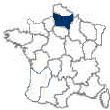
Abbeville is a town in the Département of Somme.  Its original site was as an island, in the Somme Estuary, where the local inhabitants fled from Viking attacks.  Today, it is still partly located on an island and partly on the river’s banks, at the head of the Abbeville Canal.  It is 28 miles northwest of Amiens and 12 miles southeast of the English Channel. 

Stone Age artifacts, unearthed in 1844, indicate that the site was settled in the Paleolithic Period and was important in the Bronze age.  The artifacts are displayed in the Musée de Crèvecoeur de Perthes which was named after the man who unearthed them. 

The Romans named the town Abbatis Villa.  Abbeville, by the 9th century, was a dependency of the wealthy Benedictine abbots of Saint-Riquier.  By this time, the town had become a fortress for the defense of the mouth of the Somme.  In 1131, the Normans burned down the Carolingian and Romanesque abbey.  In 1184, the town was granted a charter as a commune.  The abbey wasn’t rebuilt until the 13th century. 

First the English and then the French took turns at ruling Abbéville.  From 1272 to 1435, the city was ruled by the English and was the capital of Ponthieu.  The marriage of Louis XII and Henry VIII’s sister, Mary, took place in Abbeville.  In 1435, the first battle of the Hundred Years’ War took place just to the north.   The city then quickly fell prey to the dukes of Burgundy Louis XI annexed the town in 1477.  It latter grew into an important industrial and commercial city. 

The Edict of Nantes, which bestowed upon French Protestants partial religious freedom, was revoked in 1685.  As a consequence of the revocation, Abbeville suffered a severe economic blow that was caused by the flight of Protestant skilled labor from the town. 

In May, 1940, the rapidly advancing German army took the heights overlooking the town.  The Germans quickly strengthened the natural defenses of the area.  General Charles de Gaulle, without support, organized a counter attack by his Fourth Armored Division, against the German Panzers, on May 27-29, driving deeply into the enemy’s lines.  However, due to the ineptness of the fossilized French General Staff, he was unable to follow-up his victory.   

The German army entered Abbeville in June, 1940 after seriously damaging the city.  The Gothic cathedral of Saint-Vulfran’s 17th century vaulted choir was almost completely destroyed.  The town hall [Hôtel-de-Ville], with its 13th century tower, survived. 

Carpet factories were established in the city during the 17th century.  Breweries, ironworks and sugar beet refineries were also installed in the city.
 

The Capital of Picardy - Amiens
The ancient cathedral city of Amiens is the capital of the region of Picardy and of the Département of the Somme.  It is situated on the Somme River, along a route long used for trade and by invading armies.  It is about 75 miles north of Paris, 68 miles northwest of Reims, 71 southwest of Lille and 28 miles southeast of Abbeville.  It is the principal city of the Somme River valley. 

In pre-Roman times the city was known as Samarobriva and was the capital of the Ambiani Gauls.  The name Amiens was derived from Ambiani.  Amiens became a Roman colony and, in 54 BC, [during the Gallic War] Julius Caesar set up his headquarters here.  For the next four and one-half centuries the town was a stronghold of the Roman Empire.  Saint Firmin, the city’s first bishop, Christianized it in the 4th century. 

Amiens became a part of the medieval countship of Amiénois, where there was continuing friction between the count and the bishop.  It was given a charter, as a commune, early in 1117. 

The city was, for centuries, a major fortress guarding Paris from attack from the north.  The old citadel still stands, but the ramparts have been converted to boulevards.  In 1264 the French and English signed a truce here.  Upon the death of Charles the Bold, in 1477, Amiens became a possession of the French Crown. 

In 1802, the Treaty of Amiens was signed between the British, French, Spanish and Dutch.  This marked only a short pause in the Napoleonic Wars.  Under the treaty, England was required to give up most of the territory it had taken in previous fighting.  In May, 1803, the fighting was restarted by the English.  Because of Napoleon’s fear that the French would not be able to defend the Louisiana Territory, the possession was sold to the United States for a paltry sum.  The warring period, from 1803 to 1815, is known as the Napoleonic Wars. 

Prussian forces took Amiens during the Franco-Prussian War of 1870.  During World War I the town was a British Army base, due to its commanding position on the Somme River and its proximity to rail transportation.  In 1914, the Germans managed to enter Amiens before being beaten back to trench positions some 18 miles to the east.  The German’s final drive of the war, in 1918, was stopped just 8 miles to the east of the town.  The German bombardment of the city, during WWI, resulted in cathedral damage by artillery shells and bombs. 

In 1940, during World War II, a substantial bombardment of Amiens preceded the German occupation of the city.  The city’s center required rebuilding after the war. 

The old city, which is dominated by its Gothic cathedral, contains numerous buildings dating from the Middle Ages.  The cathedral is one of the three most famous High Gothic cathedrals in France and boasts a seldom seen homogeneity of style.  Notre-Dame Cathedral, which is one of the world’s most beautiful monuments to Gothic architecture, is also France’s largest Gothic cathedral, covering 89,875 square feet.   

The French architect, Robert de Luzarches, designed the cathedral along the lines of the Cathedral at Reims.  Work on the cathedral began in 1220 and was financed by profits made on the sale of a plant valued in making blue dye.  It was built to house the head of Saint John the Baptist that was brought back from the 1206 crusade.  A galleried façade, with a rose window and is pierced by three portals, was completed in 1236.   

Thomas de Cormont took over construction from de Luzarches, and oversaw the construction of the choir and apse through the end of 1241.  In 1269, Renaud de Cormont, the son of Thomas, completed the east end in the Ravonnant style.  Twin towers top this beautiful façade.  The portals and towers create a stunning High Gothic sculptural group.  It is among the worlds most famous of High Gothic cathedrals, and has been designated as a World Heritage Site by UNESCO. 

The cathedral’s spacious interior utilizes the dramatic open characteristics of Gothic design combined with a Romanesque logic.  Its nave sores to the height of 143 feet and contains 7 bays averaging just over 40 feet [14.6m] wide and just over 150 feet [54m] long.  The cathedral is 470 feet long and is supported by bold supporting columns.  Some 4000 16th century wood figure carvings, representing residents of Amiens, decorate the 110 oak choir stalls that were made between 1508 and 1522. The cathedral’s lead-covered wooden spire is the oldest in France.  It highest point is over 307 feet [112m] above ground and over 153 feet [56m] above the cathedral’s roof. Construction was begun in 1220 and was finished in about 1270.  Further additions to the cathedral were made through the 19th century.   

The 17th century town hall, which is in the center of the old town, was almost completely rebuilt in the 19th century.  The 15th century Church of Saint-Germaine is situated to the town hall’s north.  The Picardy museum, which is located to the south, displays medieval religious sculpture, houses a collection of 16th through 20th century paintings, 19th century marble and bronze sculptures and archaeological finds.   

The town houses many other treasures.  There is an ancient theater with a Louis XVI façade, la Maison à la Tour [the house that Jules Verne lived in], the Quartier Saint-Leu, which is crossed by a network of flower-lined Somme canals with water-side artisans’ shops, bars and restaurants and, to the east, a colorful area of marshland market gardens known as Les Hortillonages.  The University of Picardy, which was founded in 1965, is also located in Amiens. 

Amiens is a commercial, industrial and railroad center.  The city engages in food processing and manufactures carpets, chemicals, machinery, metal goods, perfumes, textiles [cotton, silk and woolen], and tires.  Its textiles have been famous since the Middle Ages.  There is also a brisk trade in grain, macaroons [the town’s specialty], oilseeds, sugar and wool.  Truck farmers, from the surrounding areas, bring their goods to the town market by small boat.

  • The Capital’s Location
  • The Capital’s History
  • The Capital’s Points of Interest
    1. The Museums
    2. The Churches
    3. The Chateaux
    4. The Restaurants
       

Beauvais
The town of Beauvais is the capital of the Oise Département of Picardy.  It is located south of Amiens and 41 miles north of Paris at the confluence of the Avelon and Thérain rivers.  It is on both the Autoroute du Nord and Route National 1.   

The town dates from a time prior to the Roman conquest when Beauvais was the capital of the Gallic Belloveci tribe.  When the Romans took the town, they called it Caesaromagus.  The town was latter known, by the Romans, as Civitas de Bellovacis and then as Bellovacum.  In 1472, the town fought off a siege by the duke of Burgundy.  Suddenly, just when the town’s people were at the point of capitulation, Jeanne Lainé [Jeanne Hachette] rallied them.  She killed an enemy soldier with an ax and pulled down the Burgundy flag he had planted.  This sole act revived the defense until reinforcements could arrive.  An annual celebration, held in June, commemorates her heroism.   

Beauvais became a countship in the 9th century.  In 1013, the bishops, to whom Beauvais had passed, became peer of France.  In 1096, Beauvais became a commune.  The peasant revolt of 1357, which was known as the Jacquerie, had its beginnings here. 

By the 17th century, Beauvais was known for its industry.  It was then that the French statesman, Jean-Baptiste Colbert, initiated tapestry manufacturing in the city.  During the 17th and 18th centuries the Beauvais tapestry factory fabricated tapestries of exceptional quality.  

The city was badly damaged in both world wars.  In 1918, during WWI, Marshal Ferdinand Foch directed Allied battle operations from the town hall.  The tapestry factory was destroyed in June, 1940, during WWII.  Today, having been rebuilt after the wars, Beauvais is a modern city. 

Ancient Roman ramparts can be found within Beauvais with the town clustering about its principal monument, the Carolingian Cathedral of Saint-Pierre.  It was begun in 1225, by the Bishop of Beauvais, and was never completed.  It was to have been the largest cathedral in Europe.  Its vault was to have been 157 feet high.  However, it collapsed in 1272 and again in 1284. 

Today, it is a remarkable Gothic structure, standing only as chapels, a choir [which is 157 feet long and is the loftiest ever constructed], and a transept.  The transept and the apse have survived several collapses.  The Basse Oeuvre, a Romanesque church, built in the 10th century, stands in the area planned for the cathedral’s nave.  Its stained glass windows, erected in the 12th, 13th and 14th centuries, stand 52 feet high.  A magnificent 90,000 part astronomical clock stands near the north entrance; it was assembled in the 1860s.  

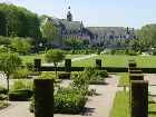
The nearby Bishop’s Palace was built in the 12th-century.  It is now the Musée Départemental de l’Oise, housing archaeological finds, local ceramics, a collection of rare furniture, medieval sculpture, 17th and 18th century paintings from the French and Italian schools and beautiful local tapestries.  

The Church of Saint-Étienne has a Jesse Window on the choir’s north side.  Its luminous blue background and transparency make it a masterpiece.  Other public buildings date from the 14th century to the 16th. 

Today, the city’s products consist of blankets, carpets, ceramic tiles, chemicals, felt, food products and tractors.


                                Google

  
www.French-at-a-Touch.com


Home AMA Waterways Cruise Uniworld Cruises Viking River Cruises  CroisiEurope River Cruises
Contact Us Avalon Waterways River Cruises Tauck River Cruises Viking Ocean Cruises Day Tours France

                                                                                         
 © Copyright 1999 - 2015 by Sharon Atchley.  All rights reserved.  Updated:  12/18/2015