|
|
Practical Information for
Guadeloupe.
List of towns and villages, their populations, basic
information and tourist offices
Tourism
Map of Guadeloupe
Back to Top ▲
Saint-Barthelemy
Location
Saint- Barthelemy is one of the dependencies of the Department of
Guadeloupe in the French West Indies. It is a small, rocky island,
surrounded by reefs.
Presentation for Saint Barthelemy
[French]
Territorial du Tourisme Saint- Barthelemy
[French]
Food and drink
Bananas, sassafras, and vegetables, much destined for export, are grown
in the fertile soil. Fishing is also important to the economy.
History
The French have occupied Saint- Barthélemy since 1648, except for the
period 1784-1877 when it was ceded to Sweden.
The history of Saint Barthelemy
People, Languages, Religions
About 5,000 people live on Saint- Barthélemy which is only 11 miles long
and 2.5 miles wide.
Photogallery of Saint Bathelemy
Government
Part of the Guadeloupe overseas department.
Saint Barthelemy
tourism [Languages: French & English]
Saint Barthelemy general information [Language: French]
Additional Information [French]
Martinique
Location
An overseas department of France, Martinique is one of the Lesser
Antilles in the eastern Caribbean. Steep cliffs on the north coast and
lower cliffs in the south form this mountainous island. There are many
coves and inlets
along the rugged coast. Trade winds bring heavy rainfall especially to
the tropical forest region in the northern mountains. In 1902 Mt. Pelee
erupted destroying the capital, St. Pierre. Temperatures are consistent
with a daily average around 78° F.
Food and Drink
Sugarcane, including rum distilling, bananas, pineapples, tomatoes,
eggplant, cabbage, tobacco, avocados, cassava and fish are major
industries as the economy is mostly agricultural. Most exports go to
France although imports are three times the exports.
Back to Top ▲
History
People, Languages, Religions
A small minority of the population are white descendants of French
settlers who speak French, the official language. But Creole is spoken
by the majority of the people who are black or mulatto. Most of the
people are Roman Catholic. The majority of people are literate as school attendance
is required through the primary grades. Unemployment is a persistent
problem and many islanders emigrate to France for work.
Government
Large subsidies are required from France to support the island. A
prefect heads the government. A popularly elected General Council forms
the legislature. Three deputies are seated in the French National
Assembly and two senators from Martinique are in the Senate. The French
formed an agreement with Cuba in 1980 to develop the Cuban economy if
Cuba would desist from subversive activities in the French Antilles.
Within site map of Martinique
Official tourism information for
Martinique
Discover Martinique
to prepare your stay on the island.
CIA World Factbook: Martinique
[Language: English] Outstanding source for demographical, and
governmental and economic information
List of towns and
villages, their populations, basic information and tourist offices
Map of Martinique
Saint Martin - Saint Maarten
Location
The northern part of the island, St. Martin, is French while the
southern part is Dutch, a part of the Netherlands Antilles. St. Martin
is one of the dependencies, along with St.-Barthélemy, of Guadeloupe,
that forms the French West Indies, one of the Leeward Islands. The trade
winds relieve the heat of hilly Saint Martin to make it a popular
destination for cruise ships. The increase in tourism has resulted in
many resort hotels.
Food and drink
Fishing and rum are mainstays of the island's economy. The loss of labor
to other islands ended the production of sugar cane and sea salt which
flourished in earlier times.
History
The Spaniards took over Saint Martin from the Dutch in 1633, just two
years after it was settled by the Dutch. In 1648 the French and Dutch
divided Saint Martin between themselves after successfully defeating the
Spanish for control of the islands now known as the Netherlands
Antilles. The British held the islands, at times, during the Napoleonic
Wars, but they were back in the hands of the Dutch in 1816.
People, Languages, Religions
The people, descendants of Africans and Europeans, are blacks who speak
English and are mostly Roman Catholic.
Government
Saint Martin is administered by the Guadeloupe overseas department.
Official Tourist Office
Saint Martin Tourism - Languages
spoken: French & English
Saint Martin CIA Factbook
Back to Top ▲
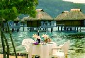
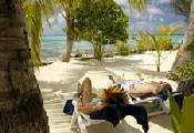
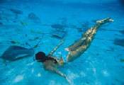
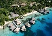
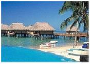
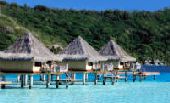
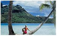
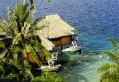
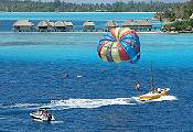
French Polynesia [Society Islands: Bora Bora, Moorea,
Papeete, Tahiti]
Location
The principal groups of islands in French Polynesia are the Gambier,
Society, Tubuai, Tuamotu, and Marquesas. They cover a land area of 1,550
square miles over 1.5 million square miles in the Pacific between
Australia and South America. Tahiti, in the Society group, like many
islands of French Polynesia are volcanic in origin. Tropical forests
cover the volcanic islands, while other islands are coral reefs, some
uninhabited, have palms and shrubs. Temperatures average about 80° F
(27° C) with a tempering trade wind. Tourism is a main industry with
Tahiti, Moorea and Bora-Bora.
Food and drink
Breadfruit, coconuts, taro, yams and bananas, pigs, cattle, goats and
poultry are raised. When phosphate mining ceased in 1966, copra became
the main export. Mother-of-pearl and vanilla are also exported.
History
Magellan discovered Tuamotu in 1521 and Tahiti was discovered in 1767 by
Samuel Wallis and claimed for Britain. But the following year France
also claimed it. James Cook named the islands the Society Islands when
he made a scientific expedition to them in 1769. The islands were called
French Oceania until it became an overseas territory in 1946. People,
Religion, Ethnic background, Language
People, Languages, Religions
Three quarters of the nearly 200,000 inhabitants live in the Society
islands, half of whom live on Tahiti. There are some Chinese and
Europeans living on the islands, but the people are predominantly
Polynesian. French is mainly spoken with native dialects on some of the
outer islands. The people are Christians, mostly Protestants.
Government
A five-member council and a governor are appointed. The thirty-member
legislature is elected with a deputy and senator sitting in the French
parliament.
Bora
Bora
Information Links
Bora Bora Official Tourist Office
Bora Bora things to do & lodging - Language
spoken: French and English
PDF with activities for Bora Bora
French
Polynesia Related Links
Map of French Polynesia and the five
archipelagos that make up French Polynesia are: The Society Islands,
comprised of of the Windward Islands and the Leeward Islands; The
Tuamotu Archipelago; The Gambier Islands; The Austral Islands; and The
Marquesas Islands.
French Polynesia general information [Language: French]
Pictures of Polynesia
from Trek Earth
CIA World Factbook: French Polynesia
[Language: English] source for demographical, governmental and economic
information.
Back to Top ▲
Moorea
Information Links
Moorea things to
see and do [Language: English]
Tahiti
Information Links
Tahiti Tourism [Languages: French & English]
The
Tahiti Traveler - the travel guide for visitors to Tahiti.
Whether it's a business trip, a romantic getaway or honeymoon, you'll find cultural and
useful information for activities, food and accommodations and much
more.
General
information on Tahiti [Languages: French & English]
Tahiti things to do & lodging [Language: English]
The Tahiti
Investment Promotion Board [Languages: French & English]
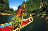
La Guyane Française [French Guiana]
Location
French Guiana is the smallest country of South America and has a small
population, most people living along the coast. Covered by jungle and
forest, it offers a tropical climate that is humid with heavy rainfalls
during April through July and December and January. There is little
temperature variation, averaging around 80° F (27° C). There are almost
no roads or means of communication except several rivers which serve as
transportation routes.
Food and drink
Rum for export is produced from sugarcane raised in Guiana. Agricultural
production does not meet the needs of the population as farming is
considered a demeaning occupation but bananas, pineapple, corn, cassava
and rice are raised. Nevertheless large amounts of food are imported.
France is the predominant trading partner and French subsidies are the
prime source of income for Guiana.
History
Trading companies were given monopolies as early as the 17th century as
a means of controlling Guiana. The Dutch and British seized control at
various times, as did a Portuguese force. Fewer than 1000 of the 12,000
French who came to colonize the country survived the first three years
after arriving in 1762. The emancipation of slaves in 1848 resulted in
the failure of the sugar plantations due to the loss of free labor. Gold
was discovered in 1853 but the location and strength of the deposits
could not sustain the initial gold rush. Isolated during its early
history, it was used as a penal colony from the middle of the 19th
century until after the end of the second world war. Disease was a main
cause of death for the convicts sent to Guiana.
People, Religion, Ethnic background, Language
Creoles, natives with some European blood, predominate, while there are
minorities of Indians, descendants of escaped slaves, and Europeans and
Chinese. A French patois with words from European languages mixed in is
spoken, while French remains the official language. Most people are
Roman Catholic. Education is free through the secondary level.
Reductions in tropical diseases have resulted from the efforts of the
Institut Pasteur in Cayenne, the capitol of Guiana.
Back to Top ▲
Government
A prefect is the French government representative in Guiana. A
fifteen-member General Council controls the budget and administers local
affairs.
Within site map of Guyane
Official tourism information for Guyane
General information [Language: French]
List of towns and villages, their populations, basic information
and tourist offices
Map of French Guiana
Loyalty Islands
Location
Part of the dependency of New Caledonia, the Loyalty Islands are in the
southwest Pacific Ocean. Uvéa, Lifou and Maré are coral islands with
many coral reefs around them. They lie about 60 miles northeast of New
Caledonia. Temperatures vary little in the tropical climate that is
cooled by trade winds.
History
The French took possession in 1866.
People, Languages, Religions
The people are mainly Melanesian, with some of Polynesian descent on
Uvéa, one of the islands making up the Loyalty Islands.
Loyalty Islands tourism [Languages: French, Japanese & English]
Mayotte
Location
Mayotte is northwest of Madagascar in the Indian Ocean, one of the
ComoroIslands. There is a coral reef forming a lagoon.
Food and drink
Oil for perfumes, vanilla, copra and coffee are exports.
History
In 1843 Mayotte became a French Possession and in 1914 was
administered by France. The Mahorais gained independence from France in
1974 but Mayotte chose to remain a part of France.
People, Languages, Religions
It is also called Mahore and the Mahorais people are Arab, African
and Malagasy. They are Muslim and Roman Catholic.
Government
Dzaoudzi is the capital of this French administered island.
Within site map of Mayotte
General information [Language: French]
CIA World Factbook: Mayotte [Language: English] Outstanding
source for demographical, governmental and economic information
Back to Top ▲
New
Caledonia
Location
Part of Melanesia, New Caledonia is a large island and archipelago in
the Southwest Pacific east of Australia. The interior valleys and
plateaus and highlands give way to a coastline with coral reefs. The
capital is Nouméa. The temperature varies little from the average of 73°
F (23° C). Trade winds and rainfall between 40 to 80 inches results in a
pleasant tropical climate. Pine forests, vines and flowering plants
thrive. There are many birds in New Caledonia, one , the white-crested
kagu can be domesticated as it cannot fly.
Food and drink:
Coconuts, saltwater fish and crustaceans are plentiful, as are bananas.
History
Melanesians came to New Caledonia before 1000 B.C., followed by
Polynesians later. The first European contact that was recorded was by
Capt. Cook in 1774. Escaped convicts from Australia, Protestant
missionaries and Roman Catholic Marists arrived in the 19th century. The
people served with the Pacific Battalion in France during World War I
and with the Free French during World War II.
People, Religion, Ethnic background, Language
French is the official language but several dialects of Melanesian are
spoken. The people are Melanesian, European, Polynesian, Indonesian and
Vietnamese living in outlying areas rather than in cities. Nearly 150
tribes, each with its own dialect, cling to their land and customs. They
are mainly Christians, Roman Catholics outnumbering Protestants, three
to one. The Melanesians keep their native customs. Nickel, the leading
export, is only one of many mineral deposits, others being iron, cobalt,
and chrome.
Government
From 1853 to 1885 there was a military government. It has been a French
overseas territory since 1946. Forty percent of the population are
Melanesians who are a strong political force in trying to regain their
independence from France.
Within site map of New Caledonia
Official Site for New
Caledonia (Nouvelle Caledonie) [Language: French]
CIA World Factbook: New Caledonia [Language: English]
Outstanding source for demographical, governmental and economic
information
General information [Language: French]
New
Caledonien tourism [Languages: French & English]
New Caledonia-Noumea
tourism [Languages: French, Japanese & English]
Caledonien Phone
Book [Languages: French & English]
Yahoue - Search
engine for New Calidonia [Languages: French & English]
Air Caledonie
airline [Languages: French & English]
Les Nouvelles Caledoniennes newspaper Language: French]
Back to Top ▲
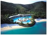
Reunion
Location
An island in the Indian Ocean, east of Madagascar, Reunion is an
overseas department of France. A mountainous island formed by a volcano,
it sill has an active volcano in the southeast. The southwestern side of
the island remains dry while the eastern coast gets rainfall brought by
trade winds. The temperatures are hot in the coastal areas where it is
also humid, while it is more temperate in higher elevations.
Food and Drink
Sugar comprises 80% of the exports. Rum, molasses, vanilla, tapioca,
tobacco and cement, iron and steel are other exports. Most exports go to
France and Madagascar.
History
The Portuguese navigator, Pedro de Mascarenhas discovered the island in
the 16th century. Although the French claimed it in 1638, they didn't
establish a settlement until 1665 for the French East India Company. It
was named Reunion during the French Revolution in 1793. It was returned
to France in 1814 after Britain had held it for four years. Called
Bourbon after the French Revolution until 1848 it was then named
Reunion.
People, Languages, Religions
The population is Creole, with descendants of Malaguay and Kaffir from
southern Africa, and immigrants from Indian, Indochina, China and East
Africa. Many were indentured servants brought to work in the sugar
fields and on coffee plantations.
Government
Reunion sends three deputies and two senators to the French National
Assembly. A prefect and a thirty-six member elected general council
govern the island. It was made an overseas department in 1947.
Within site map of Reunion
General information [Language: French]
CIA World Factbook: Reunion [Language: English] Outstanding
source for demographical, governmental and economic information
List of towns and villages, their populations, basic information
and tourist offices.
Map of Reunion
Saint-Pierre et Miquelon
Location
Saint-Pierre and Miquelon are two small islands southwest of
Newfoundland. A narrow sandbar connects Grande Miquelon and Langlade, or
Petite Miquelon. Although the islands are cold and foggy, the Gulf
Stream keeps the harbor free of ice.
Food and drink
The food is typically French, mostly subsidized and imported from
France. Fishing and the industries associated with commercial fishing,
such as canning, freezing and drying, were the main commerce. However,
since the decline of fishing on the Grand Banks, the French government
has encouraged tourism to the islands.
History
Jacques Cartier claimed the islands for the French in 1535 but the
British held them at times until 1816, since that time they have always
been French possessions. France claimed large areas of North America at
one time, but these two small islands are what remains. And it is to
these islands that the French populations came when the British expelled
them from Canada.
People, Languages, Religions
St. Pierre, the capital, is on the island of St. Pierre where most of
the people reside. French descendants, they speak French and are Roman
Catholic.
Back to Top ▲
Government
The islands were a French colony to 1946. In 1976 the French Senate made
St. Pierre and Miquelon a French Department after the population voted
to remain a territory of France in 1958. The islands are represented by
a deputy and a senator in the French Parliament.
Within site
map of
Saint-Pierre & Miquelon
General information [Language: French]
CIA World Factbook: Saint-Pierre & Miquelon [Language: English]
Outstanding source for demographical, governmental and economic
information
List of towns and villages, their populations, basic information
and tourist offices.
Map of Sant-Pierre et Miquelon
Wallis et
Futuna
Location
These two island groups that form a French overseas territory are found
in the Southwest Pacific. Their land area is 106 square miles and the
climate is hot and humid. Samuel Wallis discovered the islands in 1767
when he discovered Tahiti. The population is less than 20,000
inhabitants.
Food and drink
Taro, yams, copra, fruit and fish are the agricultural products.
History
First attached to Tahiti and later to New Caledonia, they became a
protectorate in 1887 and later colonial status. The islands voted to
become a French overseas territory in 1959.
People, Religion, Ethnic background, Language
Polynesians form the population and are Roman Catholics.
Government
A French administrator and a twenty-member Assembly govern the
territory.
Within site map of Wallis & Futuna
General information [Language: French]
CIA World Factbook: Wallis & Futuna [Language: English]
Outstanding source for demographical, governmental and economic
information
Wallis and
Futuna Tourism [Languages: French & English] Web site with
general information
Terres
Australes et Antarctiques Francaises [French Antarctic Territories]
Australasia - see more below:
Location
Three hundred islands and islets in the Indian Ocean and Adelie Land
form
the French Antarctic territories. Ile Amsterdam, Crozet Islands,
Kerguelen
Islands and Ile St. Paul are all of volcanic origin and mostly
unpopulated.
Research stations and a meteorological station are on the islands. The
French claim Adelie Land in the Antarctic and was discovered by Jules
Dumont d'Urville in 1840.
General information [Language: French]
CIA World Factbook: French Southern and Antartic Lands
[Language: English] Outstanding source for demographical,
governmental and economic information
|